

To meet the demands of modern enterprise customers in mobility space, Microsoft is unveiling a number of new capabilities for Azure Maps in the form of software development kits (SDKs) and cloud-based services.
The new capabilities will allow enterprises and partners to develop mobility solutions that can solve the complex challenges faced by cities and urban areas today.
For example, the new Azure Maps Spatial Operations is capable of taking location information and analyze it in real time. This will help in informing customers about ongoing events and enable near real-time analysis and predictive modeling of events.
There are several services available with Azure Maps Spatial Operations, which include Geofencing, Buffer, Closest Point, Great-circle distance, and Point in Polygon.
Geofencing service will help in forming an invisible fence around a specific area. It can be used in various industries. For instance, farmers can use it to enable real-time notifications when a herd leaves the field, constructors can receive notifications when an equipment leaves a construction site. Site visitors can use geofencing to get notified when they enter a hazardous zone on sites.
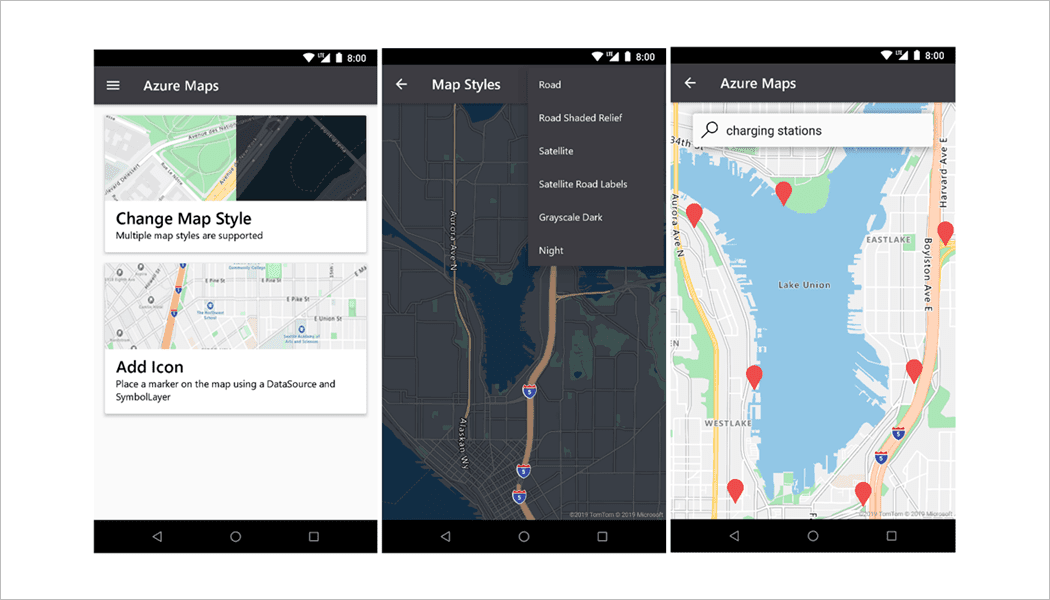
To support Android customers, Microsoft has introduced Android SDK for Azure Maps. The new SDK can be used for rendering maps and traffic, drawing, vent handling, and using various map canvases. The company said that Android SDK will equip Azure customers with tools necessary for developing smarter, faster, and more informed decisions.
“These services will provide Azure customers with the ability to offload map data processing and hosting costs all while getting the benefits of a rich set of maps and mapping services, securely with the fastest map data refresh rate available today,” wrote Chris Pendleton, Principal PM Manager, Azure Maps, in a blog post.
There are new natural earth map tiles and an image compositor that will improve the map canvas.
The tech giant is further bringing the customer data closer to Azure Maps with new data service. This service will allow them to upload and store up to 50MB of geospatial data for use with other Azure Maps services, like geofencing and image composition.
Talking about privacy and security, the tech giant is integrating Azure Maps with Azure Active Directory. It will help in protecting customer information and providing role-based access control (RBAC).
All the new capabilities mentioned above are currently available for preview.
Also read: Microsoft integrates TomTom’s mapping services into Azure Maps
The services that were previously available in public preview are moving to general availability. These services include Route Range, Get Search Polygon, and Satellite and Hybrid Imagery.
Also coming to Azure Maps is a new module that can be used in conjunction with Azure Map Control. The new module and adoption of Azure AD have warranted the need for creating a new version and encapsulating them into a single Web SDK, said the company. Hence, Microsoft will containerize its services for web developers into Azure Maps SDK 2.0


